
Making science matter in policy where nature counts
ARtificial Intelligence for Environment & Sustainability
learn moreTrain with ARIES
get started
ARIES is committed to training scientists and policy analysts to address and solve sustainability problems in new ways, with the support of artificial intelligence. By offering and contributing to PhD and Master-level courses, we help build the skills that are crucial to building a shared knowledge commons, powered by novel integrated modelling technology.
get started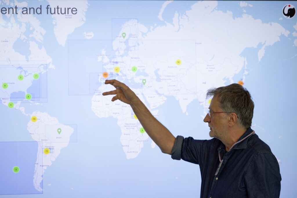

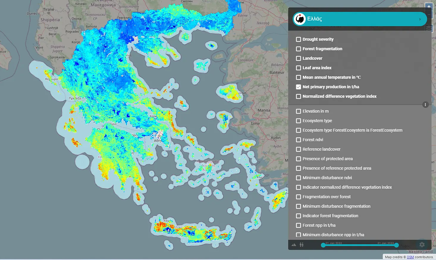
Ecosystem Services
To quantify the benefits nature provides to society, guide policies for sustainable development, and enhance resilience to environmental change.

Natural Capital
To understand, value, and effectively manage ecosystems and their services.
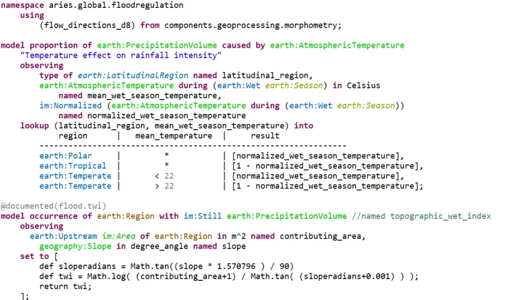
Semantic Modelling
A new approach to semantic annotation enables FAIR data and model integration through the Semantic Web paradigm.

ARIES is an international collaboration that has built, for the first time, a shared knowledge space to help address the most complex sustainability issues of our time, using the semantic web paradigm. From our central hub at the Basque Center for Climate Change we are supporting nearly 6,000 active users in 5 continents. ARIES applications range in scale from small-scale, high-resolution urban to regional and country-wide, supporting a number of government agencies, universities and NGOs on research and training to drastically change the effectiveness, speed and reliability of environmental assessments.